The best day walks in Ku-ring-gai Chase National Park
by ling and jace
home / back to australia
Ku-ring-gai Chase National Park is located on Country of the Dharug people. We acknowledge and pay our respects to the Traditional Owners.
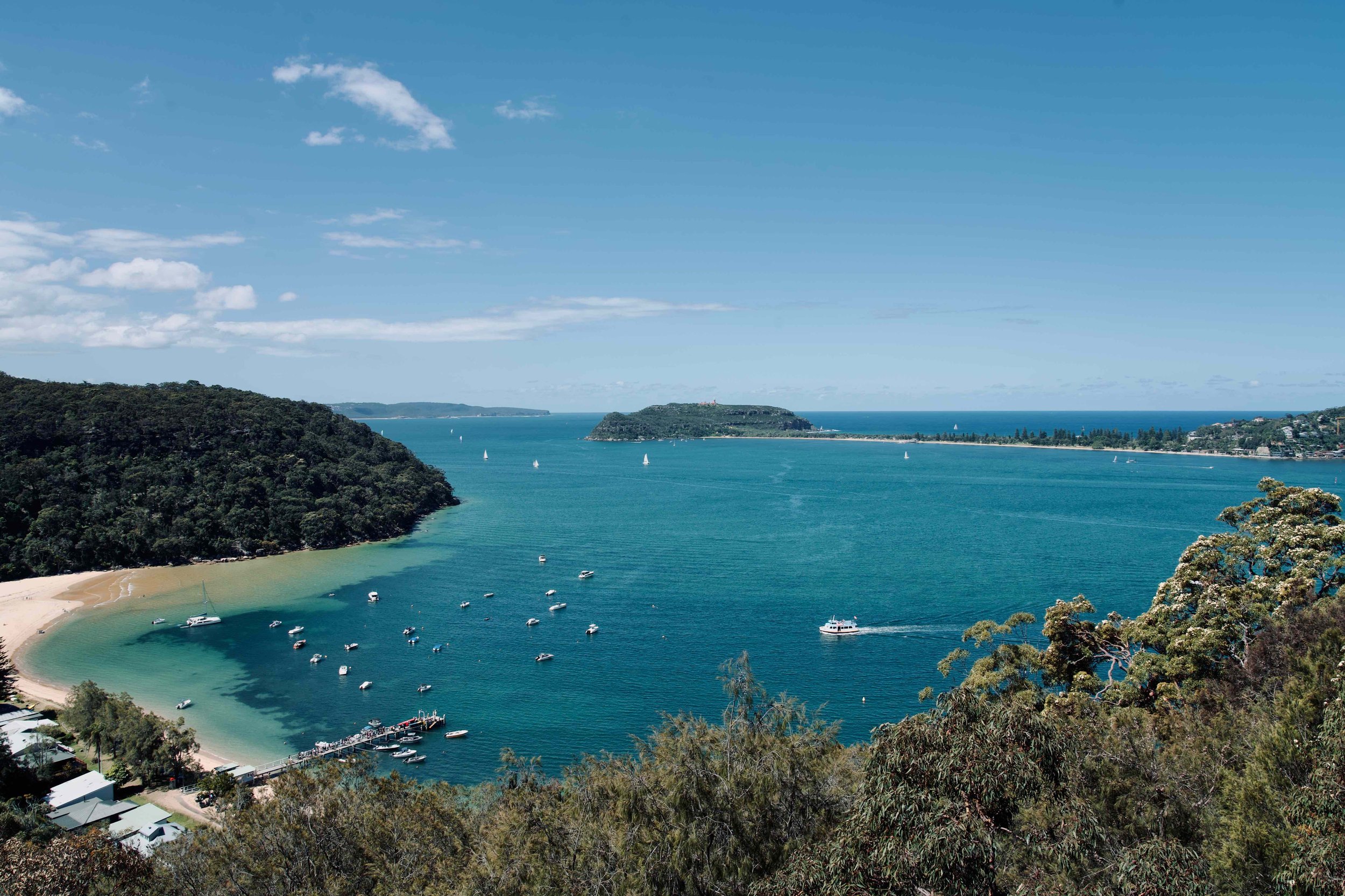
Walks in Sydney’s Ku-ring-gai Chase National Park always lead to the best coastal views.
After you get through the bush, there are so many secluded beaches at the base of the hills. We’ve spent months walking and hiking in Ku-ring-gai, yet still feel like we’re stumbling upon new secrets every time.
Here are 8 of the best day walks to choose from for a beautiful weekend getaway from Sydney.
The best day walks in Ku-ring-gai Chase National Park
Palm Beach
Great North Walk
How to get to Ku-ring-gai Chase National Park
There are bus services running from Sydney to places within Ku-ring-gai Chase National Park, like Palm Beach and Bobbin Head. However, the most convenient way to get around the national park is by car. The entrance to the national park is around 33 minutes’ drive from Sydney, and there is an entrance fee of $12 per vehicle per day.
While you’re in the area, we’d also recommend taking the Palm Beach ferry to see other beaches on Pittwater.
What to take to visit Ku-ring-gai Chase National Park
All of the locations listed in this post are easy walks, however, we recommend wearing closed shoes as we often see snakes and enormous ants in the bush. Swimmers, sunscreen, first aid and plenty of water are always a must.
The most difficult walk is Fisherman’s Track, which is not a well-marked or maintained trail, so we’d recommend extra precautions.
Mackerel Beach, Ku-ring-gai Chase National Park
The Mackerel Track
Distance: 3.2km return
Time: 1-1.5hrs return
Difficulty: Easy
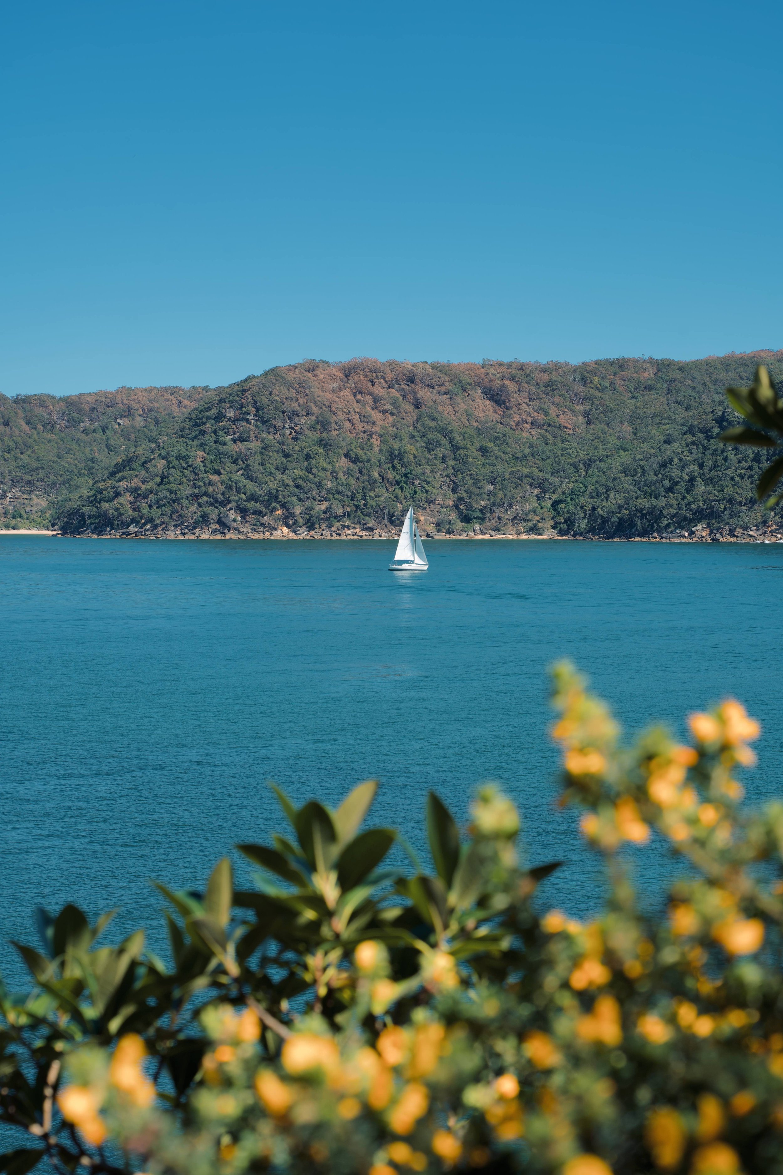
The Mackerel Track is a comfortable and relatively flat inland trail. In about half an hour, it takes you through the Ku-ring-gai Chase bush to Mackerel Trail Lookout, a rock platform looking directly over to Mackerel Beach. Mackerel Trail Lookout is the perfect place to set up for a quiet and scenic lunch, and if you’re lucky, you’ll even be able to spot wallabies foraging in the bush below the rock platform.
Mackerel Beach is one of the most secluded beaches in the Ku-ring-gai Chase National Park as it can usually only be accessed by ferry or private boat. However, if you continue further down the Mackerel Trail to Sinclair Point, it connects to Ross Smith Parade from which you can reach Mackerel Beach on foot. If you choose to continue down this trail, you should take extra care here as it is a bit overgrown by the bush and quite slippery as it’s mostly downhill.
The walk starts with the Basin Trail on West Head Road:
MAP HERE
To get to the lookout over Mackerel Beach, take the left hand turn after the Basin Aboriginal Art site on the Basin Trail.
Mackerel Beach Track

Mackerel Beach Track
The Basin Track
Distance: 6.4km return
Time: 2-2.5hrs return
Difficulty: Easy to Morderate
Right next to the Mackerel Trail (literally the same starting point) is the Basin Track which is a beautiful fire trail that leads all the way down to the Basin. It is the only campground in Ku-ring-gai Chase National Park and is a beautiful spot for a weekend or day trip out of Sydney.
MAP HERE
Resolute Beach Track

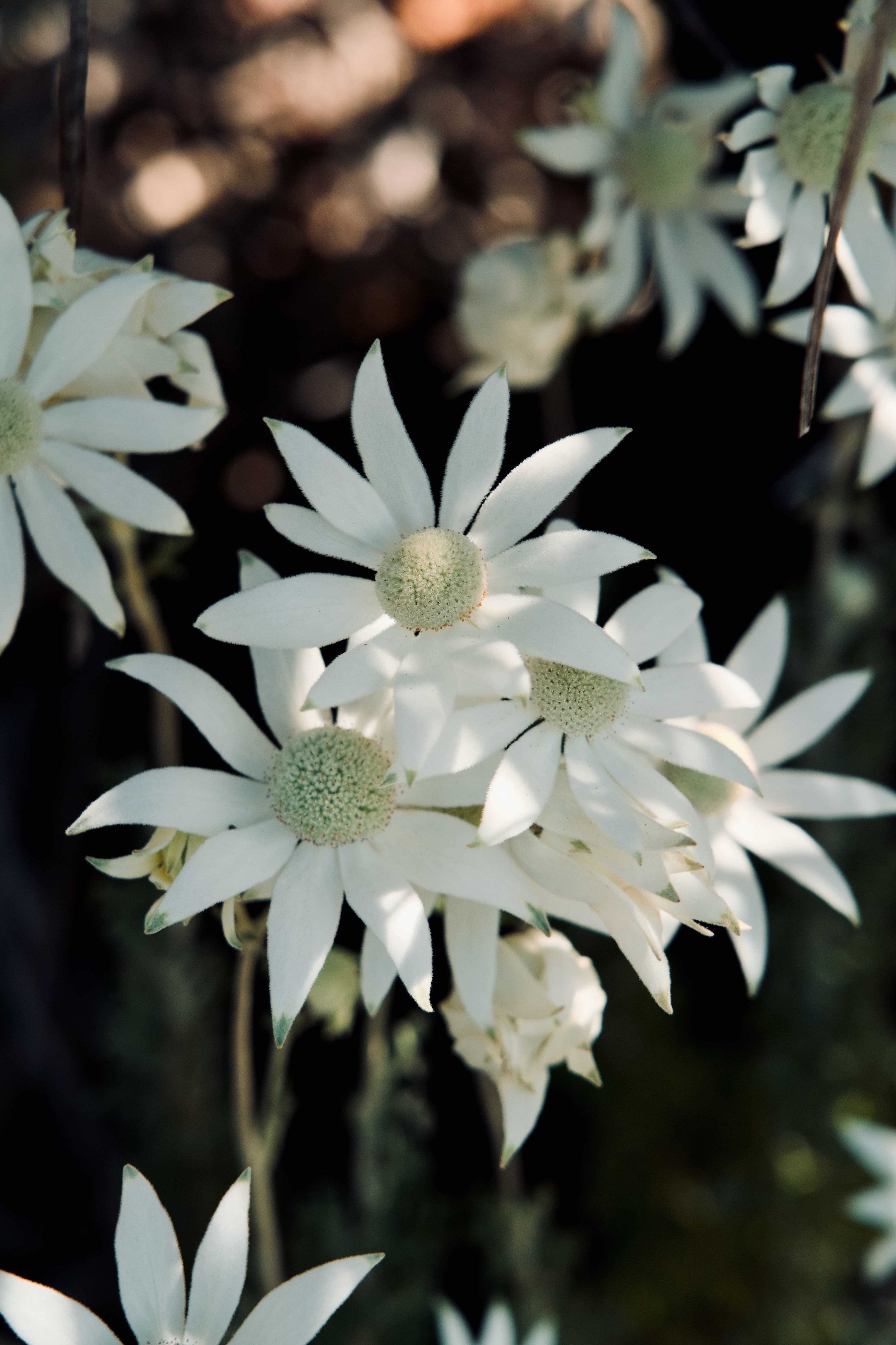
Banksias all throughout Ku-ring-gai Chase National Park
Resolute Beach Loop Trail
Distance: 6km return
Time: 1.5-2hrs to complete
Difficulty: Easy to Moderate
Our favourite walk leads to Resolute Beach, a serene and lesser-known cove at the base of the hills. We find a million reasons to come back to the Resolute Beach Trail every time we visit Ku-ring-gai Chase National Park—it’s by far one of the most beautiful places near home.
There are a few options for where you start the Resolute Beach Trail—either at the West Head Lookout or at Resolute Picnic Area. We prefer to start at the Resolute Picnic Area as the car park there is often less busy than at West Head. The walk from Resolute Picnic Area is simply stunning, starting with white sand lined by many native plants, and then leading into a very familiar Aussie bush down towards the water.
MAP HERE
The full Loop Trail is sometimes closed at the Resolute Beach side. If so, allow around 45 minutes each way from Resolute Picnic Area to Resolute Beach, and note that there are steep steps going down to Resolute Beach.

Resolute Loop Trail, Ku-ring-gai Chase National Park

Resolute Beach, Ku-ring-gai Chase National Park
Koolewong Track
Distance: 800m return
Time: 30mins return
Difficulty: Easy
The Koolewong Track is a relatively flat and easy trail that leads to a coastal clearing with beautiful views of the Hawkesbury River and the natural bodies around it. If you’re short on time or simply looking for a comfortable bush walk with stunning water views, the Koolewong Track is ideal, suitable for all fitness levels.
The Koolewong Track starts on the opposite side of the Resolute Picnic Area:
MAP HERE
America Bay Walking Track
Distance: 1.8km return
Time: 1hr return
Difficulty: Easy
The America Bay Walking Track is a charming bush walk that leads to a magnificent view of America Bay. It’s a comfortably marked trail that leads to two levels of rock platforms, perfect for lunch or tea and to soak up the sun. We really recommend this trail in the late afternoon as America Bay at golden hour is simply stunning.
The trail is suitable for all levels of fitness, but if you want to climb to the lower rock platform at the end of the trail, we’d recommend taking care as you do because the rocks can be slippery, particularly when wet.
MAP HERE
Fisherman's Track to the Seals
Distance: 1.6km return
Time: 30-45mins return
Difficulty: Hard, take plenty of care
One of the best kept secret’s within Ku-ring-gai Chase National Park is that a colony of seals migrate along the the coast each year, and pass through Barranjoey Head. The seals like to hang out in the more secluded areas around the headland, probably because the public beaches in the area are super popular and always busy.
We’ve been lucky enough to see a large group of seals from late in late September-November by hiking along Fisherman’s Track. The walk starts at the very end of Station Beach, but is not clearly marked. Look out for a path to the right of the beach beside the rocks.
Follow Fisherman’s Track until you can climb down onto the Rocks at Barranjoey Head—please be careful though as it becomes quite an unkept and slippery trail along the cliffs.

Seals on Barranjoey Head, Fisherman’s Track
Barranjoey Lighthouse Walk
Distance: 3km return
Time: 1-1.5hrs return
Difficulty: Easy
The walk up to Barranjoey Lighthouse on the headland is incredibly popular and fairly easy. You’ll find the iconic view of the split from the top—Palm beach on one side, and Station Beach on the other. Enjoy this walk with water and plenty of sun protection.
MAP HERE
This walk is right near Station Beach and Fisherman’s track, so it’s worth doing both on the same day.

Sunset view of Barrenjoey Lighthouse from Resolute Beach Track Aboriginal Engravings
Jerusalem Bay Track, Cowan to Brooklyn
Cowan Station to Jerusalem Bay
Distance: 4.9 km return
Time: 1.5-2hrs return
Difficulty: Easy to Moderate
or
Cowan Station to Brooklyn Station (or vice versa)
Distance: 13.4km one-way
Time: 5-6hrs one-way
Difficulty: Hard
Jerusalem Bay is a beautiful enclave on the Great North Walk that runs through Ku-ring-gai Chase National Park. There are two ways of accessing it, and both can be done in one day depending on how much you want to walk.
The first is from Cowan Station to Jerusalem Bay, done as a return track. This is the more common way of doing it as it’s shorter and the easier part of the trail. It’s a mostly easy trail, but there are some parts which can be quite steep and others with uneven rock paths. We find the return section harder than the descent to Jerusalem Bay as it’s a steeper climb up on the way back. But every time we do this walk, we see many families with small children managing just fine. The rock platform at the end gives you an amazing view of the bay, and it’s also a popular place to set up for lunch and go for a dip in the water. This is one of our favourite ways to spend a weekend in the bush together.
The much longer and more difficult walk is the full 13.4km track from Cowan Station to Brooklyn Station. This takes you deep through the bushland along the Hawkesbury River and passed the Brooklyn Dam. There are lots of sections that involve steep inclines which, together with the length, give the track its ‘Hard’ rating. Generally, people park at either Cowan Station or Brooklyn Station, walk the trail to the other station, and catch the train (about 9 minutes) back to their starting station to pick up their car. It’s an incredibly diverse trail which can take you to some breathtaking views and impressive clearings in the bush, although at times you will be walking through some less-scenic fire trails. It’s definitely one to do fully prepared, with the right footwear and plenty of food, water and sun protection at hand. If you’re in the mood for a long bushwalk, the Cowan to Brooklyn Track, via Jerusalem Bay, won’t disappoint.
MAP HERE
RECENT POSTS


PIN IT

Find us on Instagram

As there are long driving distances to the Sossusvlei salt pan, it was important to find convenient accommodation near the entrance. This post has 5 of the best desert stays in Sesriem, Namibia.