The best walks in Uluru-Kata Tjuta National Park
by ling and jace
Uluru-Kata Tjuta National Park is on Anangu land. We acknowledge and pay our respects to the Traditional Owners and celebrate the ongoing connection of Aboriginal people to the land and water of Australia.
home / back to australia

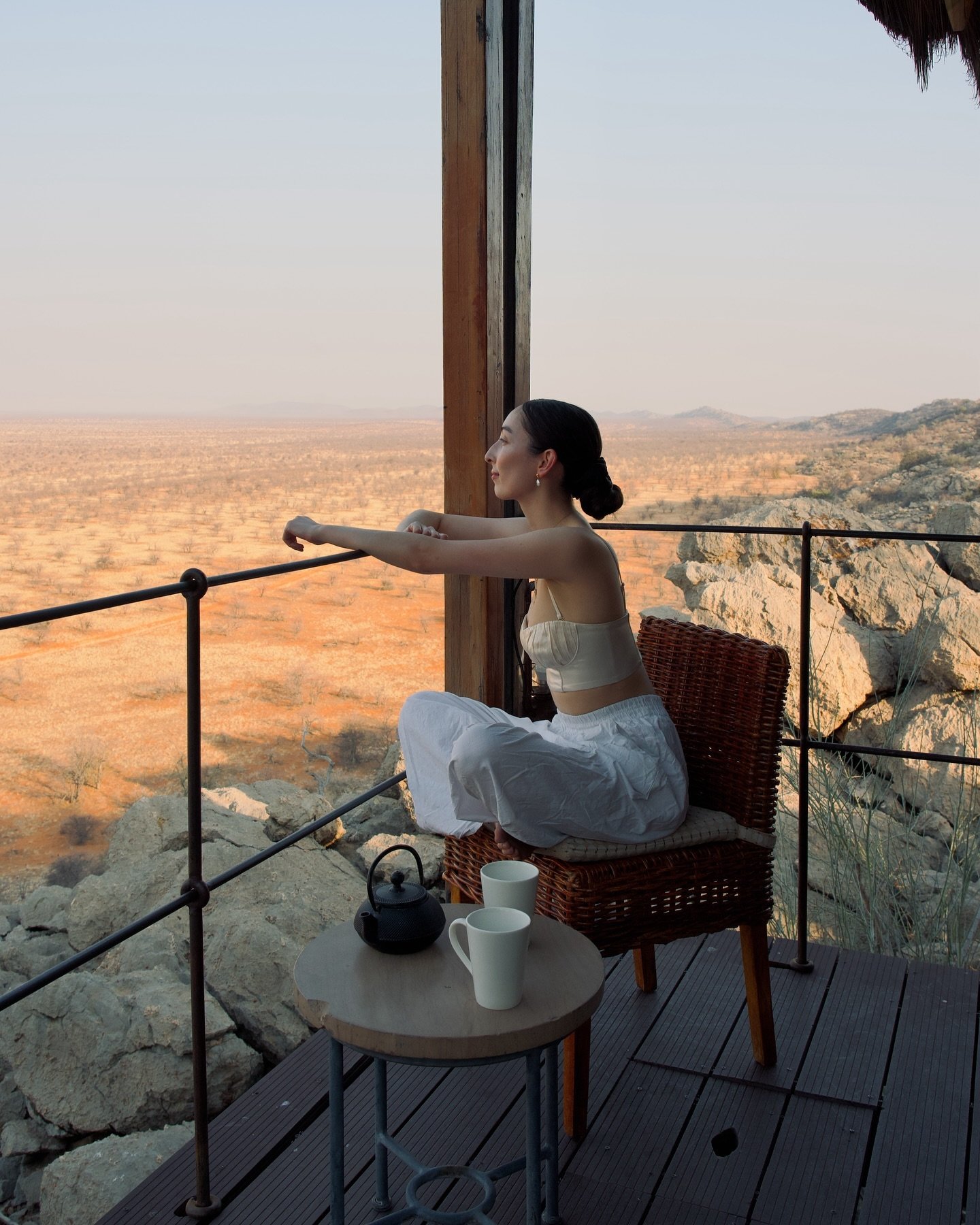
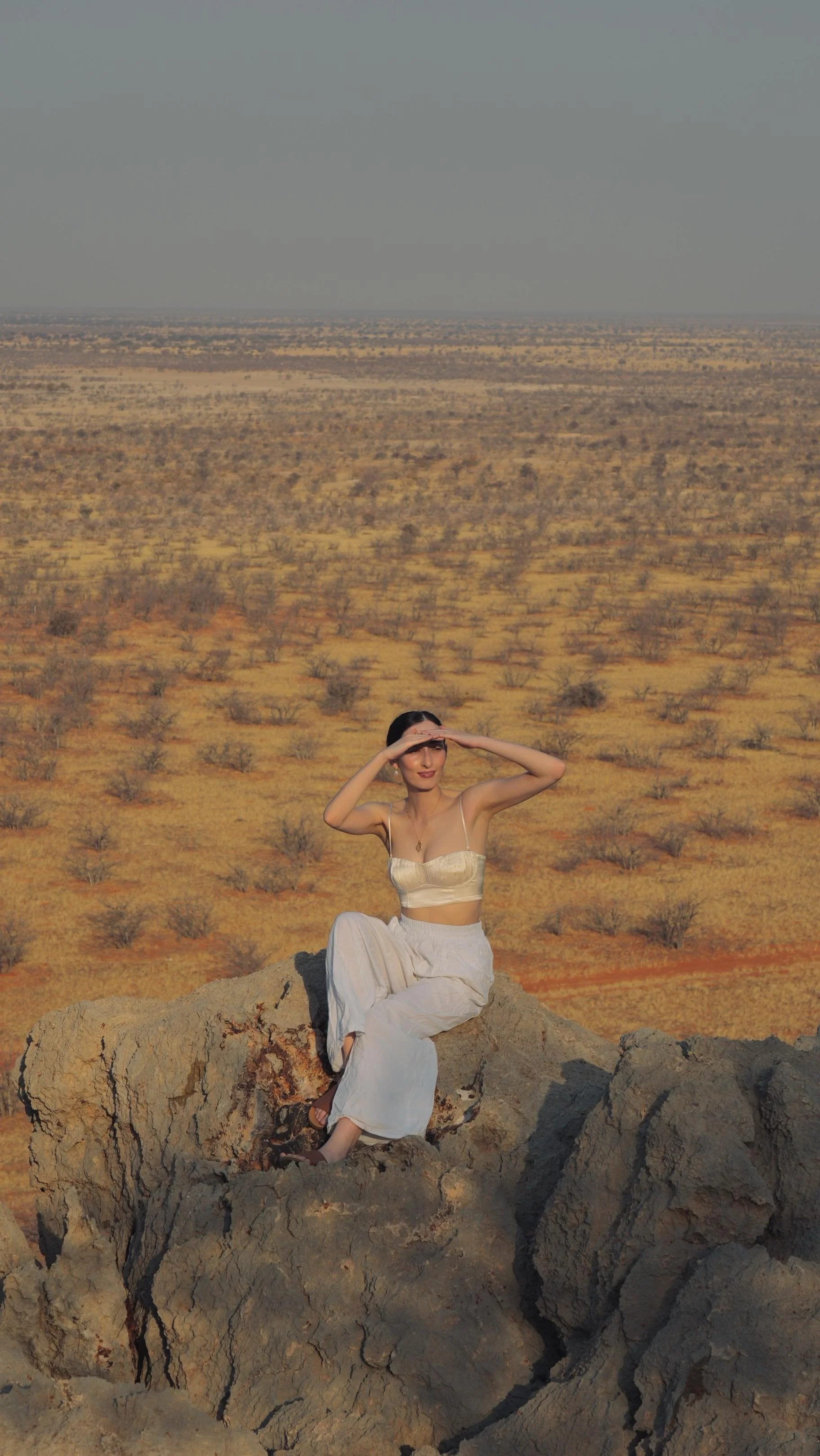
Ling on the Mala Walk at the base of Uluru
We started most mornings in Uluru-Kata Tjuta National Park watching the sunrise and then choosing a walking trail to follow before it rose too high. There are so many landscapes that can only be accessed or viewed by walking in the national park, and we’d recommend picking a few trails during any short stay to see more of the area.
There are two main regions that we’d suggest for walking: around sections of the base of Uluru or through valleys between the domes of Kata Tjuta.
This post includes everything that you need to know to choose the best walks during a visit to Uluru-Kata Tjuta National Park. We’ve included notes on distance, accessibility, culturally sensitive sites, and what to expect on each walk.
CONTENTS
We’ve separated this post into two sections:
things to know before you visit Uluru-Kata Tjuta National Park, and
the best walks in Uluru-Kata Tjuta National Park.
We’ve included links within this post—click below to jump to each section.
If you want to know more things to do in Uluru-Kata Tjuta National Park, we’ve also put together this complete guide here.
THINGS TO KNOW BEFORE Walking in ULURU-KATA TJUTA NATIONAL PARK
the best walks in ULURU-KATA TJUTA NATIONAL PARK
THINGS TO KNOW BEFORE WALKING IN ULURU-KATA TJUTA NATIONAL PARK
HOW TO GET TO WALKS IN ULURU-KATA TJUTA NATIONAL PARK
There are a few options for getting around Uluru-Kata Tjuta National Park, by car, hop-on hop-off bus (pricing and timetables are linked here), or by joining good tours.
We’ve put together a list of the best tours that we could find for walks in the national park:
Uluru sunrise base walk: this small group tour starts while it is still dark for sunrise at the base.
Uluru and Kata Tjuta base walk to sunset: this covers the base walk of Uluru and a hike in Kata Tjuta during the day, then ends with sunset from a viewing area.
Cultural sites and short walks: instead of completing this full base walk, this tour reaches cultural sites with shorter walks and a drive around the base of Uluru and Kata Tjuta.
Uluru-Kata Tjuta full-day hiking and sunset: if you’re looking for a longer tour, we’d recommend this one as it covers more of the national park with one hike in Kata Tjuta and then the base walk around Uluru. It ends with a sunset bbq.
Kata Tjuta sunrise and Valley of the Winds walk: this tour includes a hike through the Valley of the Winds (our favourite walk in the national park) after breakfast at sunrise.
Walpa Gorge afternoon trail: the Walpa Gorge hike is best in the afternoon, when the sun is directly on the rocks. This tour is a good short option which includes transport to the gorge.

Sunrise from the Kata Tjuta sunrise dune viewing area
BEST TIME OF YEAR TO WALK IN ULURU-KATA TJUTA NATIONAL PARK
Anangu recognise 5 seasons in Uluru-Kata Tjuta National Park. You can read about them here.
The better time of the year to visit Uluru-Kata Tjuta National Park is from April to September. The peak season for visiting Uluru-Kata Tjuta National Park is in the middle of winter, with clear skies and temperatures peaking in the low 20s°C.
In the summer months, it’s common for daily temperatures to be well over 36°C. When this happens, most of the trails are closed after a certain time in the morning, and it’s recommended that you aim to finish them before 11:00am to avoid the extreme heat.

Camel on Lake Amadeus, shot from scenic flight
CULTURAL SENSITIVITY AND PHOTOGRAPHY ON WALKS IN ULURU-KATA TJUTA NATIONAL PARK
Uluru-Kata Tjuta National Park is an important cultural area for Anangu. There are a number of rock details and features in the National Park that are sacred to Anangu, and should only be viewed at their original location and by certain people. Taking photos, filming, or painting these details and features is not permitted. In these areas, visitors are still welcome to photograph close ups of people, flora and fauna, as long as you’re not photographing the rock details and features that hold the cultural significance for Anangu.
Culturally sensitive sites are quite easy to identify as there are often signs on site. All of the maps that the National Park tourism board provide also clearly show the culturally significant areas are as well. See this page on their website and the brochure linked there.
In the sections below, we’ve made a note where the attractions have culturally significant sites that should not be photographed. It includes the entire north-eastern face of Uluru and many parts of the hikes in Uluru and Kata Tjuta.

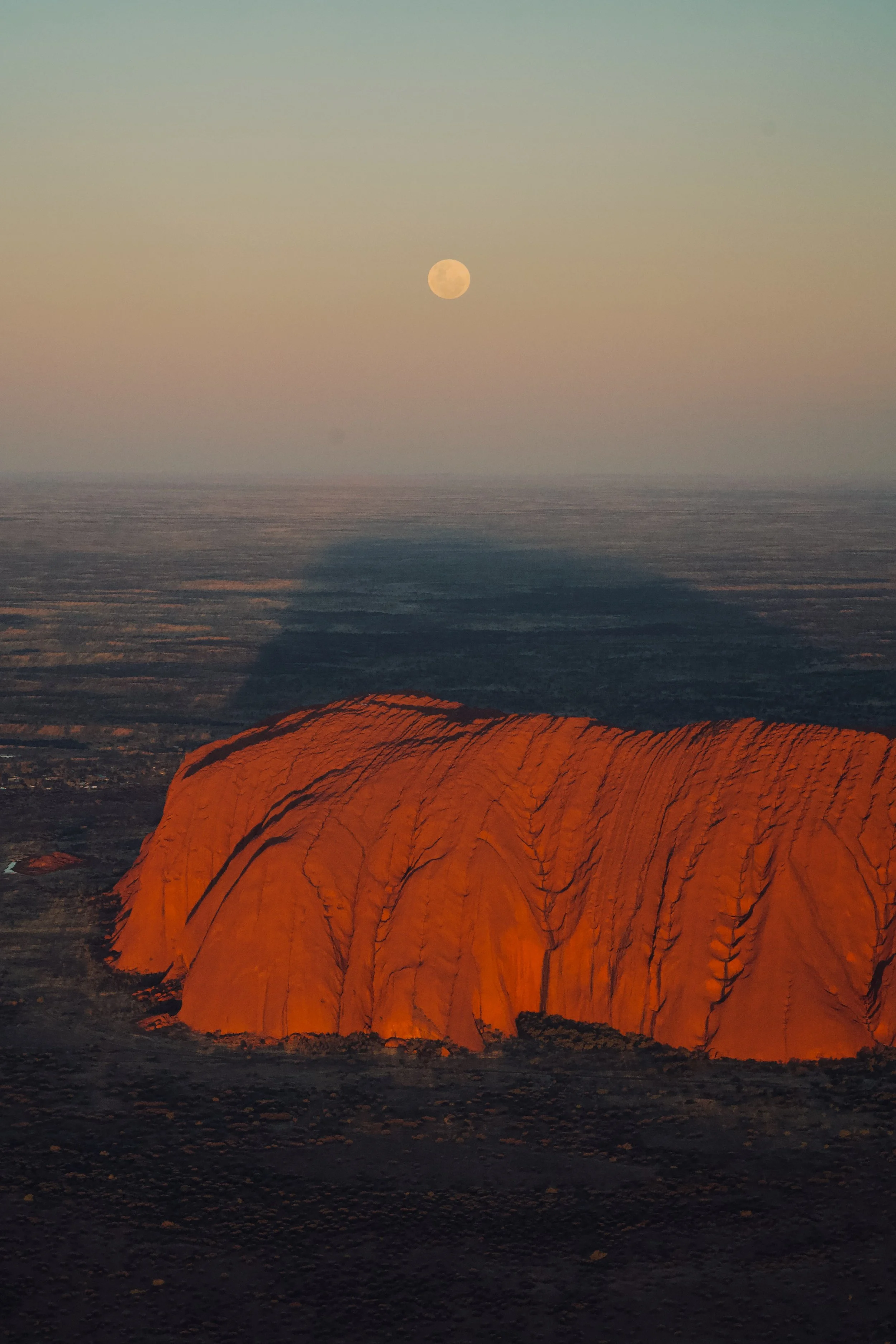
Full moon and Uluru, shot from sunset viewing area (car park)
WHAT TO TAKE ON WALKS IN ULURU-KATA TJUTA NATIONAL PARK
For all of these hikes, make sure you have plenty of water and sun protection (hats and SPF 50+ sunscreen at a minimum). For the longer hikes, we recommend taking at least 1.5L of water per person, but there are some watering points along the way.
To access these walks you’ll also need to purchase a National Park permit. Passes cost $38 per person and are valid for 3 days. At the gate, park rangers can extend the passes to 5 days (free of charge) if you’ve planned for two more days in the park.
You can purchase entry passes online, or at the gate on the day.

Sunrise over Kata Tjuta from Kata Tjuta dune viewing area
ULURU WALKS
ULURU BASE WALK
Distance: 10.6km
Time: 3-4hrs
Difficulty: easy, terrain is mostly flat and cleared dirt, and large sections will be in the shade due to the position of the sun on Uluru
Type: loop circuit
Cultural sensitivity: yes, in certain sections (identified by signs) and along the entire north-eastern face.
Uluru base walk tour: this is the best small group tour that we could find which includes sunrise over Uluru and breakfast before hiking around the base.
Alternatively, this tour covers cultural sites around the base of Uluru and Kata Tjuta (with driving and short trails instead of the full Uluru base walk).
Uluru-Kata Tjuta full-day hiking and sunset tour: if you’re looking for a longer tour which includes the base walk, we’d recommend this one as it covers more of the national park. It follows two hikes (one in Kata Tjuta and then the base walk) and ends with sunset over Uluru.
The Uluru base walk starts at the Mala carpark and loops around Uluru in its entirety. You really get a sense of how big Uluru is by being underneath it, and pass a lot of cultural and historical artefacts along the way. There are fresh water taps and bathrooms at the Mala carpark and the Kuniya Piti checkpoint which is roughly halfway into the walk.
Ling on the Mala Walk at the base of Uluru
Shadow behind Uluru, shot from scenic flight
The base walk is also separated into different sections which can all be done individually if you aren’t able to complete the entire circuit at once. These are:
MALA WALK TO KANTJU GORGE
Distance: 2km in and out return
Time: 1hr
Cultural sensitivity: yes, in certain sections (identified by signs)
NORTH-EAST FACE WALK TO KUNIYA PITI
Distance: 4-5km one way
Time: 1.5-2hrs
Cultural sensitivity: yes, the entire walk
KUNIYA TO MUTITJULU WATERHOLE WALK
Distance: 1km in and out return
Time: 30-45mins
Cultural sensitivity: no
LUNGKATA TO KUNIYA PITI WALK
Distance: 4km one way
Time: 1.5-2hrs
Cultural sensitivity: yes, in certain sections (identified by signs)
LIRU WALK
Distance: 4km
Time: 1.5-2hrs
Difficulty: easy to moderate
Type: one way
Cultural sensitivity: no
This walk connects the Cultural Centre to the Mala carpark. It has fantastic views of the south-western face of Uluru for the duration of the walk.
MINYMAKU AND WATIKU WALKS
Talinguru Nyakunytjaku (the sunrise viewing area) is fantastic for watching the sun rise over Uluru, and also contains 2 short, wheelchair accessible walks to viewing platforms:
Minymaku Walk (Women’s Walk)
Watiku Walk (Men’s Walk)
The Minymaku Walk (Women’s Walk) is about a 1km loop which teaches you about women’s business, such as processing bush foods and games for children. The Watiku Walk (Men’s Walk) is about a 1.5km loop walk which teaches you about men’s business, such as tool making and hunting.
If you’re driving, it’s about 25 minutes’ drive from Yulara, and we would recommend arriving 15-20 minutes before sunrise to beat the crowds.

Sunrise behind Uluru shot from Kata Tjuta dune viewing area

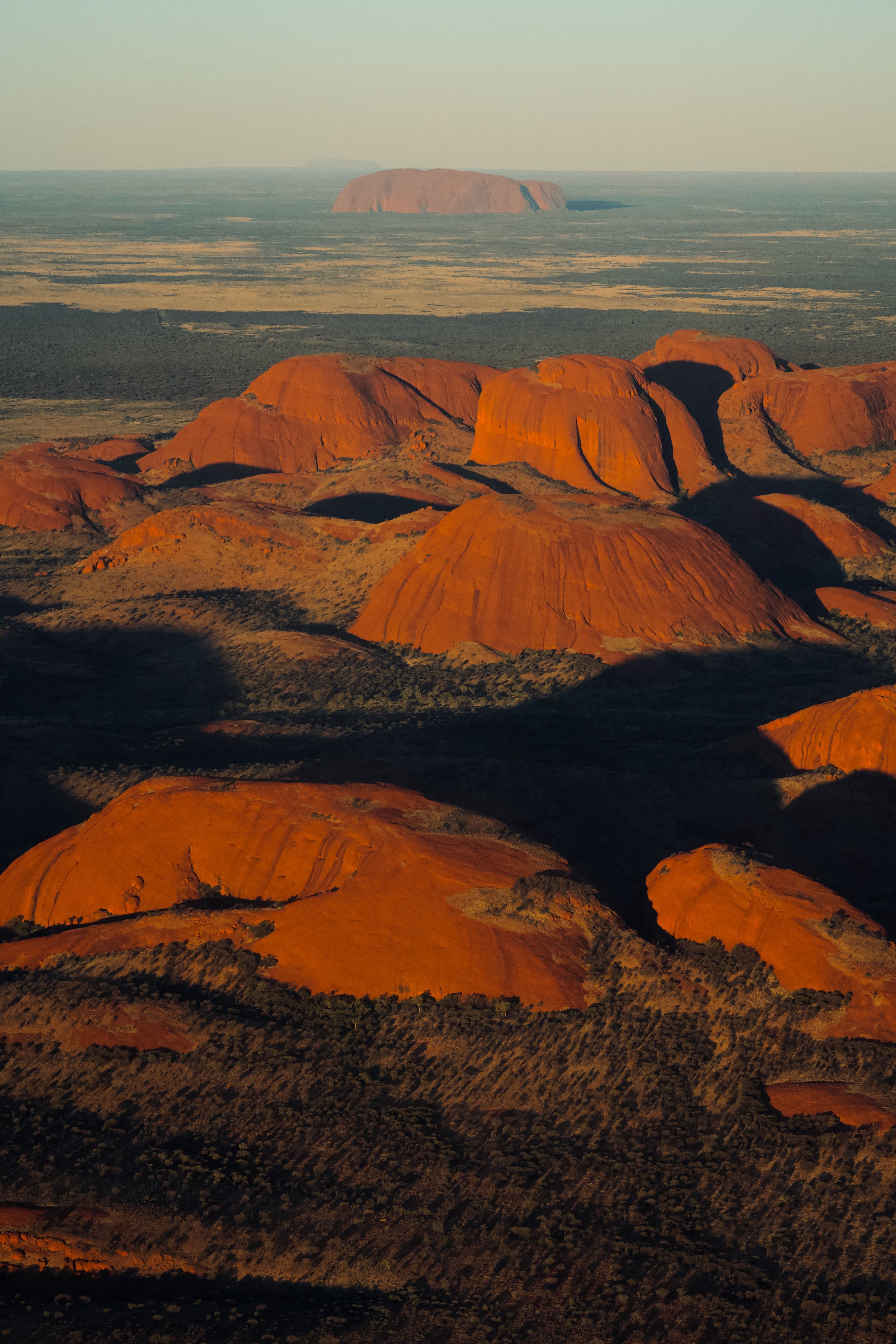
Uluru and Kata Tjuta, shot from scenic flight
KATA TJUTA WALKS
WALPA GORGE WALK (KATA TJUTA)
Distance: 2.6km in and out return
Time: 1hr
Difficulty: easy
Cultural sensitivity: yes, Anangu ask that you keep both sides of the gorge in frame when you film, paint, draw or photograph Walpa Gorge and that you walk quietly through the area.
This is an easy and beautiful in and out trail to a view of a gorge. Around sunset, the colours of the rock valley walls glow. a stunning red, making it a beautiful spot to enjoy the end of the day.
Walpa Gorge short tour and hike: the Walpa Gorge hike is best in the afternoon, when the sun is directly on the rocks. This tour is a good short option which includes hotel transfer to the gorge.

View from the start of the Walpa Gorge walk at sunset

View at the end of the Walpa Gorge walk
VALLEY OF THE WINDS CIRCUIT WALK (KATA TJUTA)
Distance: 7.4km loop
Time: 3-4hrs
Difficulty: mostly moderate, with some steep sections of incline
Terrain is a mix of clear dirt and rocky paths
Type: circuit loop
Cultural sensitivity: yes, Anangu ask that you do not take any photos of the rock in the valley while you are on the walk.
Sunrise and Valley of the Winds tour: if you want to hike through the Valley of the Winds, this tour includes transport, sunrise lookout over Kata Tjuta and breakfast before a guided hike through the valley.
The Valley of the Winds circuit is one of the most unforgettable walks in all of Uluru-Kata Tjuta National Park. The trail passes between some of the domes that make up the Kata Tjuta rock structure itself.
Indigenous elders ask visitors not to take photograph most parts of this trail as it winds through sacred areas. Photos are permitted at Karingana Lookout, which is where this incredible view the valley is taken from. Photos are also permitted of flora, fauna and people (close up) that block the details of the rocks.
There are 2 lookouts along the way where you can optionally return from if you don’t want to complete the full circuit:
Karu Lookout (about 1hr, 2.2km return)
Karingana Lookout (about 2.5hrs, 5.4km return)
We highly recommend you conitnue to Karingana Lookout, as it gives the most spectacular view of a hidden landscape in the distance between the dome walls.
Always carry plenty of water and sun protection, but note there are 2 points where you can refill water on the circuit too. During the warmer months, it’s highly recommended that you finish before 11am as large sections of the walk is exposed to the sun.

Karingana Lookout (photos permitted), Valley of the Winds
Sunrise from the Kata Tjuta sunrise dune viewing area before Valley of the Winds hike

Wildlife on the Valley of the Winds walk

Sunset over Kata Tjuta, shot from scenic flight
RECENT POSTS


PIN IT

Find us on Instagram